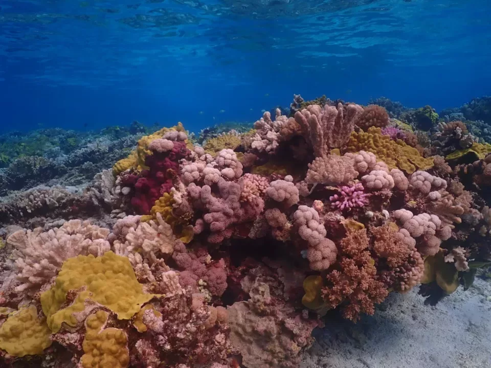

The Allen Coral Atlas is combining both coral science and satellite imagery with mapping and monitoring techniques in order to create a game-changing scientific tool in the effort to help reef science and conservation. The Allen Coral Atlas was conceived and funded by the late Paul Allen’s Vulcan Inc. and is managed by the Arizona State University Center for Global Discovery and Conservation Science. Along with partners from Planet Labs, the University of Queensland’s (UQ) Remote Sensing Research Centre, and The National Geographic Society, the Atlas utilizes high-resolution satellite imagery and advanced analytics to map and monitor the world’s coral reefs in unprecedented detail. These products support coral reef science, management, conservation, teaching and policy across the planet.
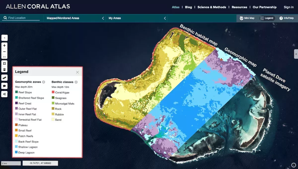
The Allen Coral Atlas is producing the first globally consistent geomorphic (12 zones; max. depth 15 m) and benthic habitat (6 classes; max. depth 10m) mosaic maps for all shallow water tropical coral reefs (not affected by turbidity or deep water). Having now mapped 70% of the worlds reefs, the Allen Coral Atlas will soon have freely available habitat maps of the entire globe. In addition to these maps, the Atlas also features analytical and monitoring tools, including a real time coral bleaching detection capability, which sees changes in the spectral signature of corals over time. For more information see the Science and Methods page on the Allen Coral Atlas.
How you can help with our mapping efforts
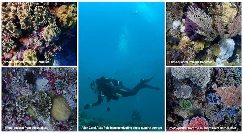
Unfortunately, due to covid-19 restrictions, we’ve had to rely mostly on existing verification data collected by the wider coral reef community to support our mapping efforts. Thus, we are reaching out to ICRI community members in the hopes that you, your organisations, or even somebody you might know, have existing habitat maps and/or georeferenced benthic data to help with our global mapping efforts. We are using such data in conjunction with low-tide Planet Dove satellite image mosaics, in order to manually interpret a set of reference samples. These reference samples are used to train the machine learning process, which is followed by an object-based clean-up process, in order to create these maps; an approach developed and implemented by the UQ mapping team (Lyons et al 2020, Roelfsema et al 2021, Kennedy et al 2020).These data are also used to help validate the resultant geomorphic and benthic habitat maps. We are extremely grateful to all those who have already rallied behind the Atlas and generously shared coral reef data to help with our mapping efforts, and whose contributions have been attributed on our website. However, we are seeking additional verification data in order to improve the quality of the Atlas maps.
Specifically, we are currently in the process of compiling benthic data for the Middle East (specifically, from the Red Sea, Gulf of Aden and North-western Arabian Sea), Eastern Micronesia, Central South Pacific, Tropical Eastern Pacific, as well as Northwest Africa, Brazil and Japan. Although we are prioritising data collection for these unmapped regions, any data shared for previously mapped regions will be reserved and used in future map updates.
If you have georeferenced data that you are interested in sharing with us to support our mapping effort, please contact us at [email protected] – we’d love to hear from you! Any data provided to the Allen Coral Atlas will only be used internally to help create (or improve) our maps and will not be published or shared outside our team. Also, as highlighted above, all shared data that is used to calibrate and validate Allen Coral Atlas maps will be attributed on our website.
Using the Allen Coral Atlas to support, inform and inspire critical action
The Allen Coral Atlas is creating this freely available scientific tool to help protect and preserve our coral reef ecosystems. Therefore, if you have found the Atlas maps and monitoring tools helpful for your own research endeavours, please don’t hesitate to reach out and tell us! If you would like to learn more about remote sensing and mapping for coral reef conservation, please check out our three free online courses that were created in association with The Nature Conservancy.
Together, with the right tools, we can inform and inspire critical action to help protect and preserve the world’s coral reefs.
Article provided by Chantel Say.